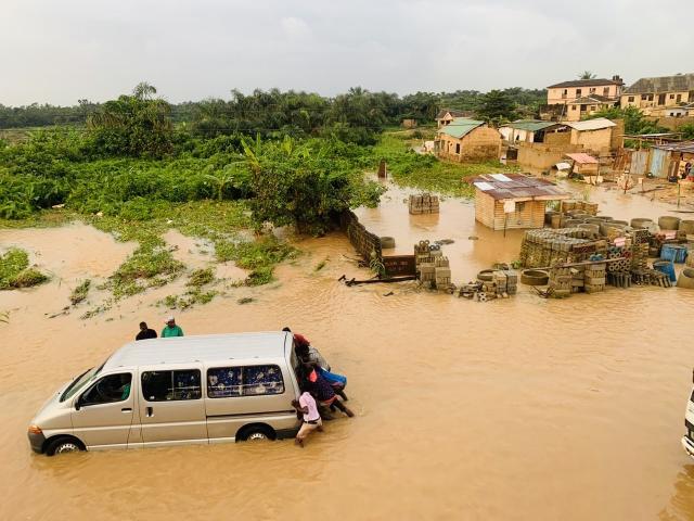
When floodwaters swallowed the Agric and Ijede communities of Ikorodu on August 4, 2025, homes and cars were left underwater and families were forced to flee. In the middle of the devastation, Oluwadamilola Salau, a PhD candidate in the Department of Geography in the College of Arts and Sciences, was on the ground in Lagos, Nigeria with her team documenting the disaster in real time
With support from the Office of International Affairs International Research and Scholar Grant, Salau, an international student from Nigeria, had been conducting fieldwork during the rainy season, using a rain gauge and measuring staff to record rainfall and track flood depth. The catastrophic August flood became a pivotal moment, showing how climate change and human activity combine to create deadly risks in fast-growing cities.

Conversations with residents revealed how local projects , such as bridge construction in Agric and an abandoned drainage system in Ijede, worsened the impacts of heavy rain. For Salau, the experience highlighted how flooding in Lagos is not only an environmental problem but also a social and political one.
The project’s main accomplishment was documenting flood depth and extent and identifying both natural and human-made drivers of risk. The data collected will be combined with information on land use, slope, drainage density, soil and precipitation to build an artificial intelligence–based flood model.
This model will assess current flood risks and predict how they may change with climate shifts, offering insights to guide disaster preparation, climate adaptation and urban planning in Lagos and other flood-prone cities.